


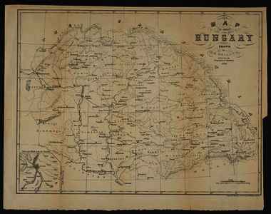
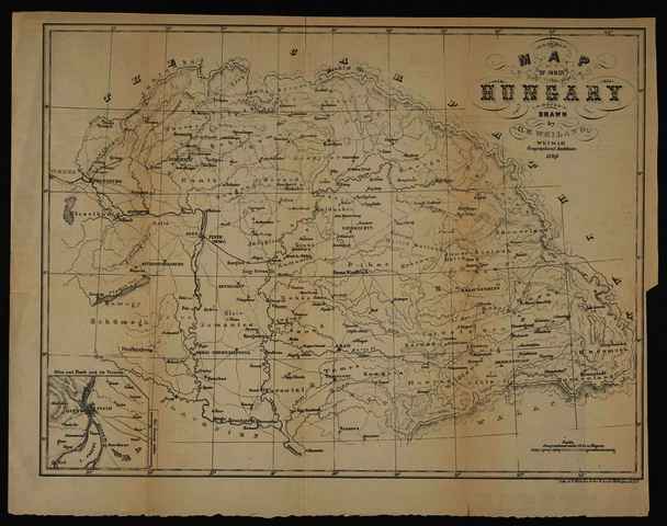
Weiland, Carl Ferdinand (Kartográfus): Map of Inner Hungary. (1852)
![[img]](https://real-i.mtak.hu/19297/1/Terkep_535.jpg)
|
Kép
Terkep_535.jpg Letöltés (2MB) | Előzetes bemutató |
|
![[img]](https://real-i.mtak.hu/19297/2/Terkep_535_H.jpg)
|
Kép
Terkep_535_H.jpg Letöltés (886kB) | Előzetes bemutató |
| Tétel típus: | Térkép | ||||||
|---|---|---|---|---|---|---|---|
| További információk: | Kiadó / terjesztő: Charles Scribner Raktári szám: Térkép 535 | ||||||
| Szabad kulcsszavak: | Szántai Lajos Magyarország általános térkép | ||||||
| Szakterület(ek): | G Geography. Anthropology. Recreation / földrajz, antropológia, kikapcsolódás > GA Mathematical geography. Cartography / földméréstan, geodézia, térképészet | ||||||
| Intézmények: | MTA Könyvtár és Információs Központ > MTA KIK Kézirattár és Régi Könyvek Gyűjteménye | ||||||
| Feltöltő: | Bálint Tóth | ||||||
| Alkotók: |
|
||||||
| Elhelyezés dátuma: | 09 Júli 2025 13:45 | ||||||
| Utolsó változtatás: | 12 Dec 2025 10:10 | ||||||
| URI: | https://real-i.mtak.hu/id/eprint/19297 |
Szerkesztés (Bejelentkezés szükséges)
 |
Tétel szekesztése |
