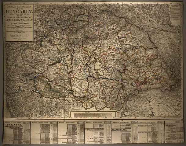


Lipszky, János (Kartográfus): Tabula generalis regni Hungariae Croatiae et Slavoniae, nec non magni principatus Transylvaniae conspectum mappae generalis in IX. sectiones moduli majoris distributae Civitates, Oppida, Stationes et vias Postales singillatim accurateque exhibens,. (1810)
![[img]](https://real-i.mtak.hu/19569/1/Terkep_669.jpg)
|
Kép
Terkep_669.jpg Letöltés (14MB) | Előzetes bemutató |
| Tétel típus: | Térkép | ||||||
|---|---|---|---|---|---|---|---|
| További információk: | Kiadó / terjesztő: Lipszky J. Kiadás helye: Pest Raktári szám: Térkép 669 | ||||||
| Szabad kulcsszavak: | Szántai Lajos, Magyarország, általános térkép | ||||||
| Szakterület(ek): | G Geography. Anthropology. Recreation / földrajz, antropológia, kikapcsolódás > GA Mathematical geography. Cartography / földméréstan, geodézia, térképészet | ||||||
| Intézmények: | MTA Könyvtár és Információs Központ > MTA KIK Kézirattár és Régi Könyvek Gyűjteménye | ||||||
| Feltöltő: | Bálint Tóth | ||||||
| Alkotók: |
|
||||||
| Elhelyezés dátuma: | 04 Aug 2025 13:09 | ||||||
| Utolsó változtatás: | 12 Dec 2025 10:15 | ||||||
| URI: | https://real-i.mtak.hu/id/eprint/19569 |
Szerkesztés (Bejelentkezés szükséges)
 |
Tétel szekesztése |