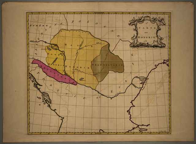
I.e Carte de Hongrie
Palairet, Jean
(Kartográfus):
I.e Carte de Hongrie.
(1755)
| Tétel típus: |
Térkép
|
| További információk: |
OSZK Földabrosz: Oktatási célú atlasz lapja, mely mű a szerző Nouvelle introduction à la geographie c. tankönyvének atlaszkötete
Méretarány az atlasz másik, azonos léptékű Magyarország-térképének méretaránya alapján
Kiadó / terjesztő: J. Nourse, P. Vaillant, J. Néaulme, P. Gosse
Raktári szám: Térkép 688 |
| Szabad kulcsszavak: |
Szántai Lajos, Magyarország, általános térkép, iskolai térkép |
| Szakterület(ek): |
G Geography. Anthropology. Recreation / földrajz, antropológia, kikapcsolódás > GA Mathematical geography. Cartography / földméréstan, geodézia, térképészet |
| Intézmények: |
MTA Könyvtár és Információs Központ > MTA KIK Kézirattár és Régi Könyvek Gyűjteménye |
| Feltöltő: |
Bálint Tóth
|
| Alkotók: |
| Közreműködés típusa | Név | Alkotó azonosító |
|---|
| Kartográfus | Palairet, Jean | MEGHATÁROZATLAN |
|
| Elhelyezés dátuma: |
05 Aug 2025 09:11 |
| Utolsó változtatás: |
12 Dec 2025 10:20 |
| URI: |
https://real-i.mtak.hu/id/eprint/19590 |
Szerkesztés (Bejelentkezés szükséges)
 |
Tétel szekesztése |
|



![[img]](https://real-i.mtak.hu/19590/2/Terkep_688.jpg)