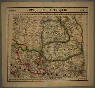
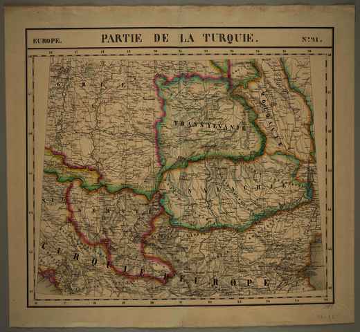
Europe. N.O 21. Partie de la Turquie
Vandermaelen, Philippe Marie Guilleaume
(Kartográfus):
Europe. N.O 21. Partie de la Turquie.
(1827)
| Tétel típus: |
Térkép
|
| További információk: |
OSZK Földabrosz:
Az atlasz lapjait a francia litográfus, Henri Ode metszette kőre; ld. az atlasz címlapját, ill. Atl. Neerl., 3. köt., Vdm 1, Note
A befoglaló atlasz 374 lapját Ph. Vandermaelen egy méretarányban, Sanson-Flamsteed kúpvetületben szerkesztette. ld. az atlasz címlapját, ill. Atl. Neerl., 3. köt., Vdm 1, Note
Kiadó / terjesztő: Ph. Vandermaelen
Raktári szám: Térkép 761 |
| Szabad kulcsszavak: |
Szántai Lajos, Magyarország, Északkelet-Balkán, Oszmán-török Birodalom európai része, általános térkép |
| Szakterület(ek): |
G Geography. Anthropology. Recreation / földrajz, antropológia, kikapcsolódás > GA Mathematical geography. Cartography / földméréstan, geodézia, térképészet |
| Intézmények: |
MTA Könyvtár és Információs Központ > MTA KIK Kézirattár és Régi Könyvek Gyűjteménye |
| Feltöltő: |
Bálint Tóth
|
| Alkotók: |
| Közreműködés típusa | Név | Alkotó azonosító |
|---|
| Kartográfus | Vandermaelen, Philippe Marie Guilleaume | MEGHATÁROZATLAN |
|
| Elhelyezés dátuma: |
11 Aug 2025 08:03 |
| Utolsó változtatás: |
12 Dec 2025 10:14 |
| URI: |
https://real-i.mtak.hu/id/eprint/19734 |
Szerkesztés (Bejelentkezés szükséges)
 |
Tétel szekesztése |
|


![[img]](https://real-i.mtak.hu/19734/1/Terkep_761.jpg)
