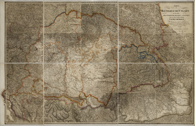


Liechtenstern, Joseph Marx von (Egyéb): Karte vom Kœnigreiche Ungarn mit Einschluss der Königreiche Kroazien und Slavonien dann von dem Grossfürstenthume Siebenbürgen. (1809)
![[img]](https://real-i.mtak.hu/19816/1/Terkep_807.jpg)
|
Kép
Terkep_807.jpg Letöltés (180MB) | Előzetes bemutató |

| Tétel típus: | Térkép | ||||||
|---|---|---|---|---|---|---|---|
| További információk: | OSZK Földabrosz: J. M. v. Liechtenstern 64 lapos Közép-Európa térképének 20 lapjából (36-40, 44-48, 52-56, 60-64) összeállított, címfelirattal ellátott, önálló kiadvány A forrásmű, a Közép-Európa-térkép vonatkozó 20 szelvényét (így ennek a térképnek a 20 szelvényét is) S. Partsch (47, 48, 53, 55, 56, 61), M. Novack (37, 39, 63, 64), J. v. Schorrer (36, 45), F. W. v. Streit (44, 52, 60), F. Simm (38,46), F. Schloif (54), A. Schneider (40), E. v. Zuccheri (62) rajzolta; J. Kühn (37, 38, 53, 63, 64), J. List (36, 44, 45, 52, 60-62), A. Withalm (39, 40, 46-48, 54-56) metszette; ld. Dörflinger 1988, Lie 61 Kiadó / terjesztő: J. M. v. Liechtenstern Kiadás helye: Bécs Raktári szám: Térkép 807 | ||||||
| Szabad kulcsszavak: | Szántai Lajos, Magyarország, általános térkép | ||||||
| Szakterület(ek): | G Geography. Anthropology. Recreation / földrajz, antropológia, kikapcsolódás > GA Mathematical geography. Cartography / földméréstan, geodézia, térképészet | ||||||
| Intézmények: | MTA Könyvtár és Információs Központ > MTA KIK Kézirattár és Régi Könyvek Gyűjteménye | ||||||
| Feltöltő: | Bálint Tóth | ||||||
| Alkotók: |
|
||||||
| Elhelyezés dátuma: | 14 Aug 2025 12:34 | ||||||
| Utolsó változtatás: | 29 Aug 2025 09:26 | ||||||
| URI: | https://real-i.mtak.hu/id/eprint/19816 |
Szerkesztés (Bejelentkezés szükséges)
 |
Tétel szekesztése |