Kogutowicz, Manó
(Kartográfus):
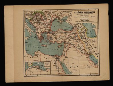
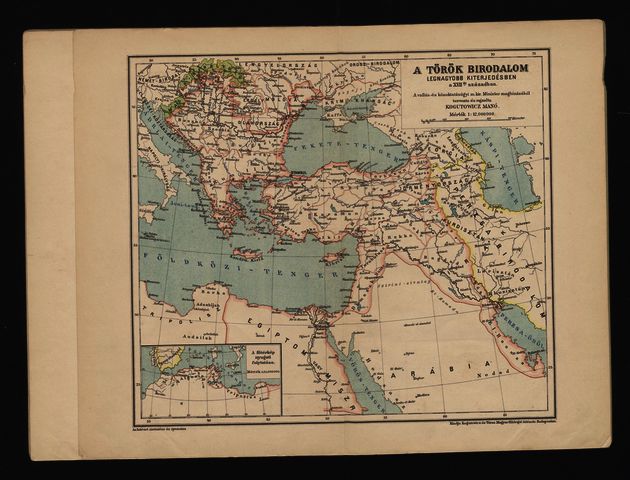
A török birodalom legnagyobb kiterjedésében a XVII-ik században.
(1896)
| Tétel típus: |
Térkép
|
| További információk: |
Tervezte és rajzolta Kogutowicz Manó. Lelőhely: Országos Széchényi Könyvtár Térképtár TA 2.741 A-7, ST 66 |
| Feltöltő: |
Erika Bilicsi
|
| Alkotók: |
| Közreműködés típusa | Név | Alkotó azonosító |
|---|
| Kartográfus | Kogutowicz, Manó | MEGHATÁROZATLAN |
|
| Elhelyezés dátuma: |
16 Júli 2021 14:35 |
| Utolsó változtatás: |
15 Szep 2021 09:35 |
| URI: |
http://real-i.mtak.hu/id/eprint/7 |
Szerkesztés (Bejelentkezés szükséges)
 |
Tétel szekesztése |


![[img]](http://real-i.mtak.hu/7/1/TA_2741_A-07.jpg)
